There is, in most senses, nothing especially noteworthy about the town of Baarle. It’s home to a little shy of 10,000 people – hardly anyone, in the scheme of things.
It’s around 50 miles from the sea and 30 from the nearest big city, Antwerp. And, despite sitting atop one of Europe’s main political faultlines, the break between the French and German worlds that has been troubling European history for much of the last 1,200 years, few things of note seem ever to have happened here.
It’s not even especially accessible to travellers: the motorways bypass it; the railway station closed in 1934, and the line has been pulled up and turned into a cycle path, which is an adorably Dutch thing to do. And yet this nondescript place attracts thousands of visitors every year.
In 2017, Willem van Gool, chair of the Baarle tourist office, told the BBC that his home had a “number of shops, hotels and cafes… more suited to a town of 40,000 rather than 9,000”. The very existence of a tourist office in a town this size feels like a telling thing in itself.
The reason all these people descend on this nondescript town, the thing all those tourists come to see, is a sort of geopolitical freak show. Because Baarle isn’t one town but two, a Belgian one surrounded by a Dutch one, and with yet more parcels of the Netherlands buried within it.
Baarle-Hertog and Baarle-Nassau – so intertwined that in places the border literally runs through the middle of buildings, so that you can be in bed in one country while the partner beside you is asleep in another – are home to one of the most stupid international borders in the world.
This situation can be traced, as can so many in this part of the world, to a combination of medieval posh people and the Holy Roman empire. In the late 12th century, this entire region was the fief of an emperor who was more often than not a very long way away.
On a day-to-day basis, though, things were the responsibility of assorted smaller, more local lords and bishops, and by 1198, two rival groups – the Counts of Holland, to the north-west, and those of Brabant, to the south – were having a row about which of them owned the area around Baarle.
Such rows had a nasty tendency to end in bloodshed (see: all European history, 476 to now). On this occasion, though, Hendrik I of Brabant found a way out. By fair means or foul, he got the even more local power, Godfried van Schoten, the Lord of Breda, to acknowledge him as his superior, in effect granting him rights to the territory, but then immediately loaned it back.
Van Schoten got to keep everything that belonged to him anyway, with all its lovely tax revenues, plus some more bits of land to say thank you; Hendrik got the rest of the land, with its lovely tax revenues, while getting the Count of Holland off his back.
If the map of the territories around the village of Baarle looked like a jigsaw, well, that didn’t really matter because Baarle wasn’t anywhere to speak of and nobody in the late 12th century was much in the business of making maps anyway.
This is the sort of feudal wheeling and dealing that was going on constantly in much of medieval Europe, and most of it isn’t significant today. The reason this bit does is because, four and a half centuries later, the Netherlands’ 80-year war of independence from the Spanish empire ended with a peace treaty that put the two lots of feudal territories on opposite sides of a line.
Those belonging to the lords of Breda, by now in the hands of the Counts of Nassau, would be part of the independent Dutch Republic to their north; those belonging to the dukes of Brabant would remain part of the Habsburg empire, like those to their south.
They were briefly united in a single polity, the United Kingdom of the Netherlands, in 1815, but in 1830, the Belgians fought their own war of independence and the area around Baarle was divided once again.
Baarle itself, in fact, proved such a contentious matter that the 1843 Treaty of Maastricht that delineated the border divided it up into more than 5,000 discrete packages of land. A number of commissions have since been tasked with simplifying the border, most recently in 1995.
But while they’ve succeeded in cutting the number of parcels of land into which the town is divided by a couple of orders of magnitude, it remains, by any sensible standard, a mess.
The Dutch town of Baarle-Nassau, named for its former owners, contains two-thirds of the area’s population and 90% of its land, but that still leaves approximately 3,000 Belgian citizens in the Belgian enclaves of Baarle-Hertog, several miles north of the Netherlands’ border with Belgium.
You’ll notice I said “enclaves”. That’s because Baarle-Hertog is not a single territory but a couple of dozen discrete patches of land, the largest roughly 1.5km2, the smallest equivalent to a square just 50m on each side.
Exactly how many of these there are is surprisingly hard to pin down: different sources claim anywhere between 22 and 26, which tells you something in itself. There’s more agreement on the number of Dutch enclaves within these patches of Belgian territory, of which there are eight (though some sources seem to have forgotten the one across the border, inside Belgium proper, and only count seven).
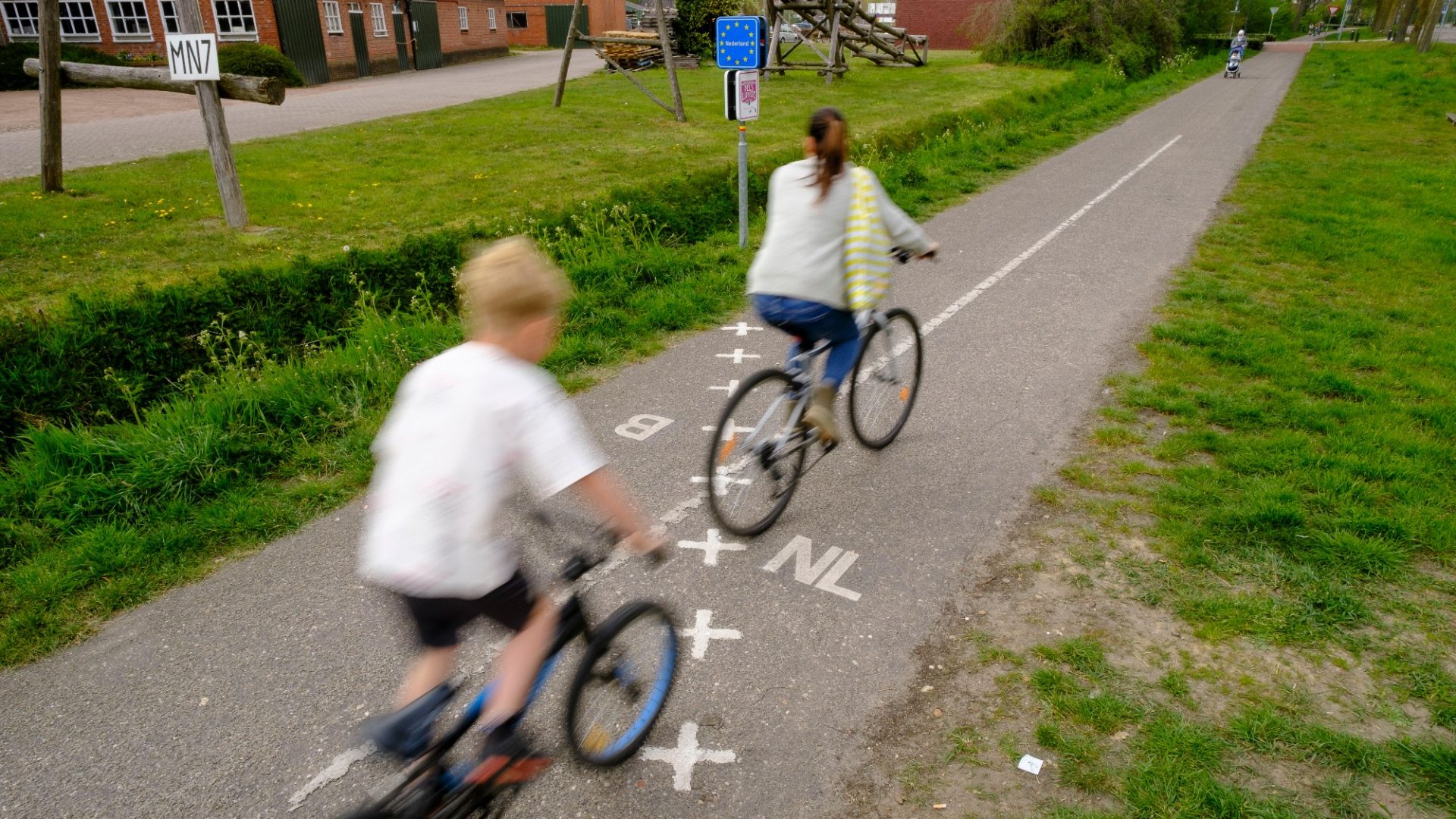
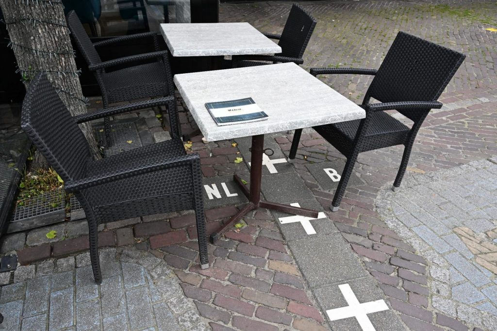
So messy is this arrangement that the border, marked on the ground by lines of neat white crosses and by plaques showing Dutch or Belgian flags on the fronts of houses, frequently divides buildings in half. In one place, it enters a block through a gift shop and leaves it by a supermarket; in another, it runs through the middle of a bathroom, dividing toilet from bath.
In most cases, this is less of a pain than one might imagine – however the land a property sits on is divided up, it is treated as belonging to the territory that contains its front door. But in some places the border runs through the front door itself. The town deals with that by giving said buildings two different addresses, one for each nationality.
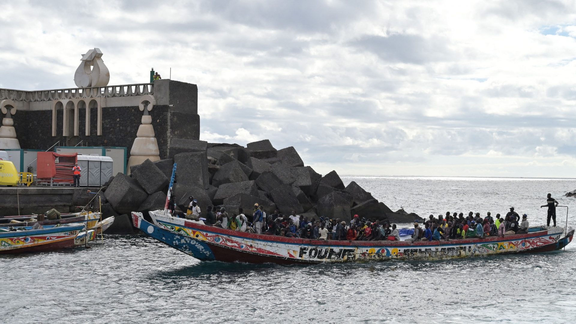
Messy as the border is, it has not, in recent history, been particularly consequential. The two countries are as close as two sovereign states can be. Although the existence of free Belgian enclaves inside the neutral Netherlands may have acted as a beacon for refugees and thus annoyed the Imperial German forces occupying Belgium during the first world war, Baarle has never really bothered the realm of international relations.
That does not mean that this unusual situation has had no effect more locally. Those located on the right side of the border historically benefited from Belgium’s more permissive trading laws, opening on Sundays when Protestant Dutch shopkeepers were in church.
Apocryphal stories abound of restaurants asking their customers to move to the more liberal Belgian side of the room at the hour when Dutch law required them to close, or of banks pushing paperwork from one end of the building to another to avoid tax inspectors.
These may or may not be true – everyone includes them in their write-ups, but they would, wouldn’t they? What definitely is true, though, is that Dutch town planning laws are more restrictive than their Belgian equivalents, something still visible now in the more architecturally diverse Belgian areas.
Property owners have also been known to move their front doors across the border to take advantage of Belgium’s more liberal regime. Those in the Belgian parts of town have been able to take advantage of more permissive laws concerning selling fireworks, and drinks to teenagers.
As fun as all this is, though, it is also a pain in the backside: you try properly maintaining a road or a sewer that switches countries multiple times along its length. It also means that what is, let’s not forget, one town needs to maintain two police forces and two mayors, one of whom – the Belgian one – is based in a town hall they’re not allowed to extend without planning permission from a foreign government.
In the 1960s, the mayors even agreed to stagger the time that their two towns’ schools ended for the day, to reduce the chance that marauding gangs of Dutch and Belgian schoolkids would spend their afternoon merrily beating each other up in a cheerily patriotic manner.
The greatest recent absurdity came in June 2020, when the Netherlands decided to reopen after the first wave of the Covid pandemic, even as its southern neighbour continued lockdown. That meant that the bars of Baarle-Nassau reopened, but it was illegal for any resident of Baarle-Hertog to set foot in one, even if they lived on the same street, potentially leaving them open to a €250 fine. (The latter’s mayor said he would not be enforcing the law.)
On the other side of the balance sheet, though, Baarle-Hertog and Baarle-Nassau have shown that, with the right attitude, it’s possible for two nationalities to share a single town, and to do so quite happily. And it does attract a lot of tourists. So, even if the arrangement is very silly indeed, who’s to say it’s not a good thing?
A History of the World in 47 Borders by Jonn Elledge is out now, published by Wildfire